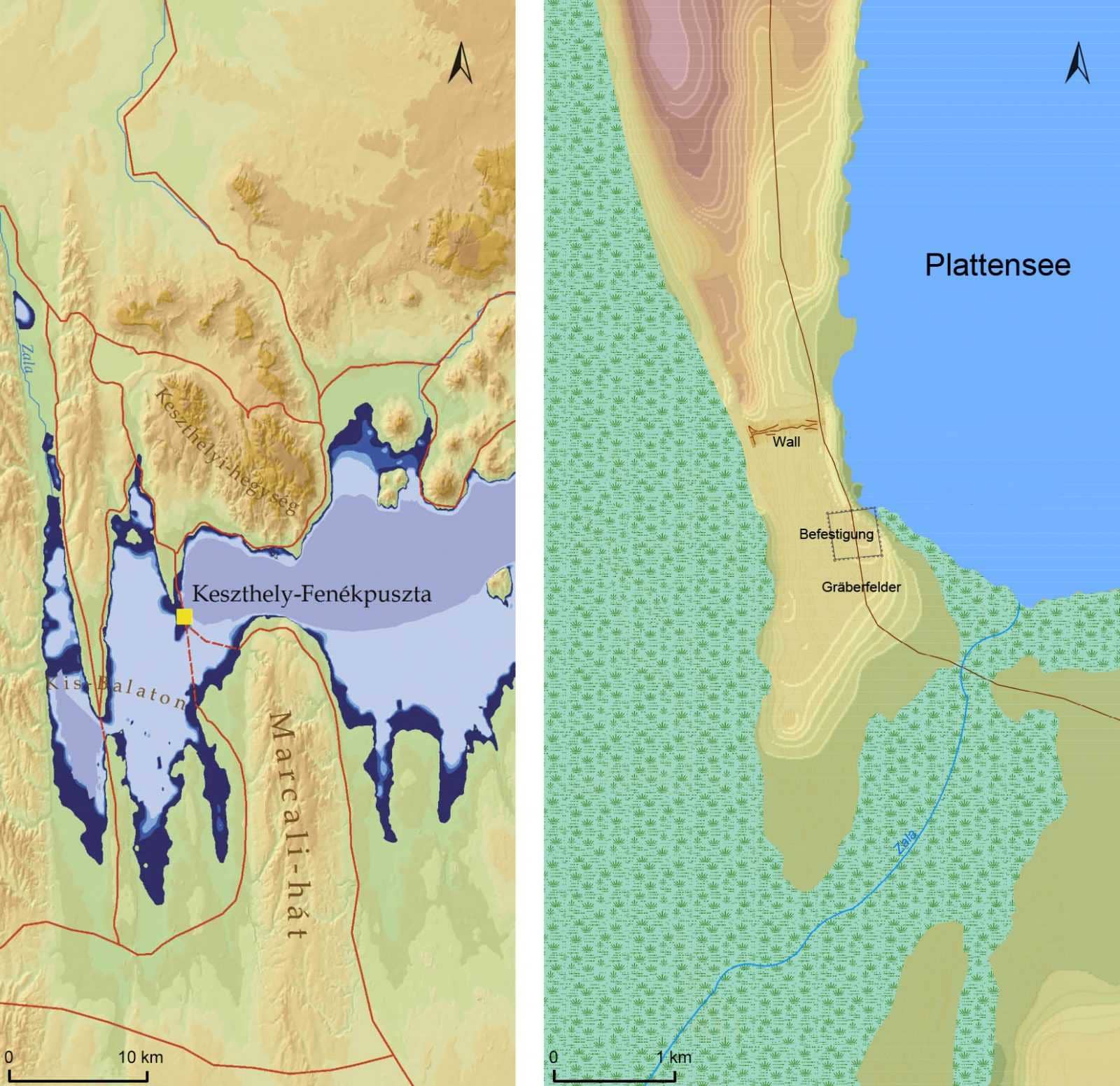
Environmental history of Fenékpuszta
The Late Roman fortification and its surroundings are an internationally significant area.
The 18th century historical maps still depict extensive marshlands here. Also palpable is the natural-topographical stand of the Late Roman fortification at the southern tip of the loess ridge.
Anthropogenetic impacts determine the present aspect of Lake Balaton: dams, drainage and enbankments. Although the anthropogenetic impacts have had a long history, the historical landscape greatly differed from that of today.
The environment of the fortification have changed according to the method and measure of human intervention in different periods. The most important factors to generate changes have been agriculture, water regulation, infrastructure between settlements, and settlement structures.
The reconstruction of these changes provides vital data to realize one-time environmental and living conditions. It is especially true as concerns Kis-Balaton region that includes Fenékpuszta at its western edge.
Since the 19th century there has been a debate on the time, formation, process, and geographical base of Lake Balaton. From a geological point of view it is a young, 18.000-20.000 year old formation. Tectonic movements initated the formation of the lake. Along the so-called Balaton fault line a succession of clearly separate basins developed. Waters accumulating in them have eventually formed the present shape of Lake Balaton. Keszthely Basin is the oldest that had developed before the northern part of Szigliget and Szemes basins.
The water-level changes of Lake Balaton
The water level of Lake Balaton essentially depends on the water of Zala River and the capacity of the sluice of Siófok
The water level of Lake Balaton (besides evaporation and smaller streams) essentially depends on the water output of Zala River and the capacity of the sluice of Siófok to drain excess water. Former river valleys of north-south direction break up the southern shore, then open funnel-like towards the shore of the lake (groves). Between the valleys, loess ridges of the Somogy hills lie. Lake Balaton used to have high water fluctuations in historical times: the highest water level may have been over 111 ms, while the lowest could be about 104 ms above see level.
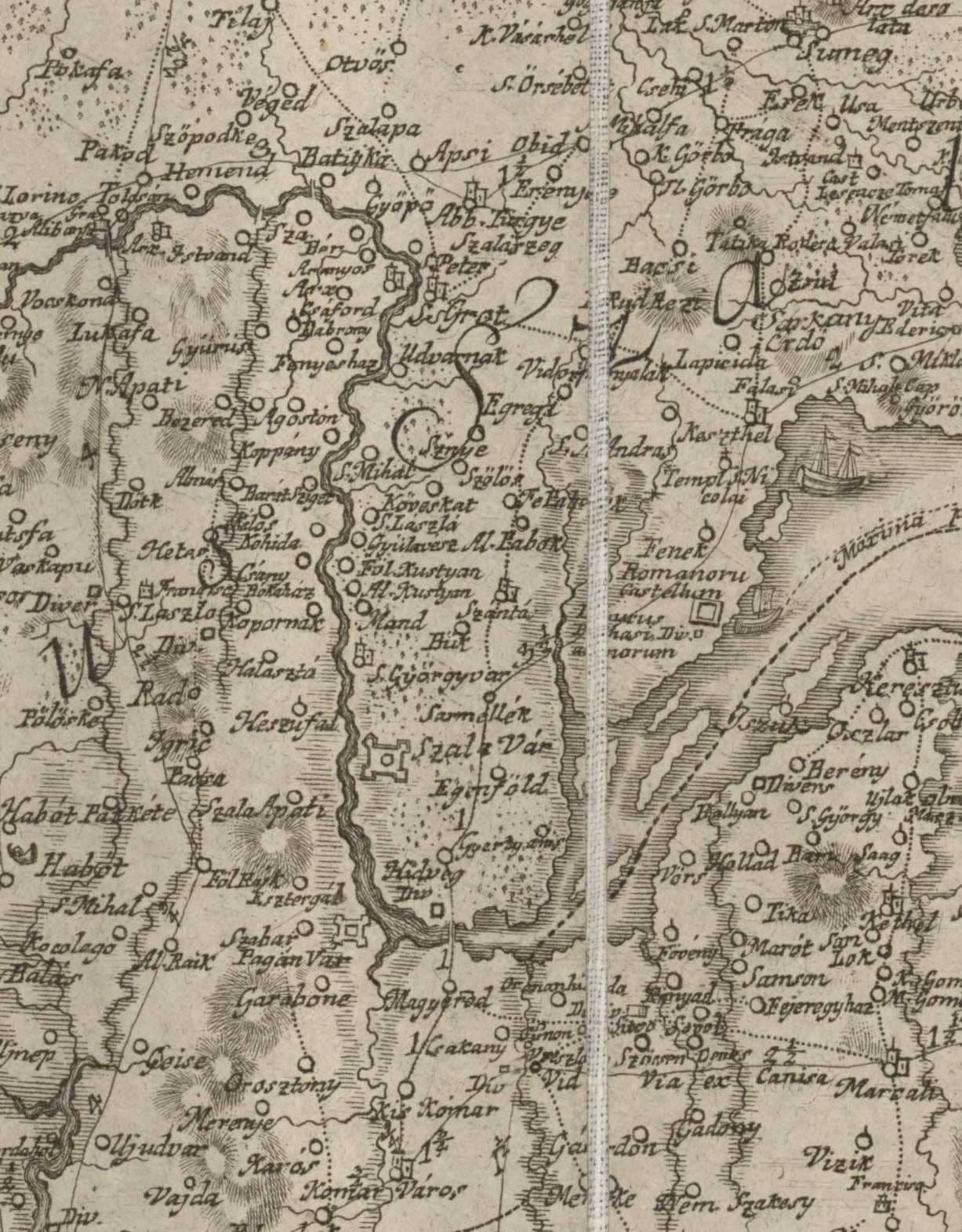
Fenékpuszta on historical maps
Maps from the recent centuries provide important sources to the research of Fenékpuszta and its environs
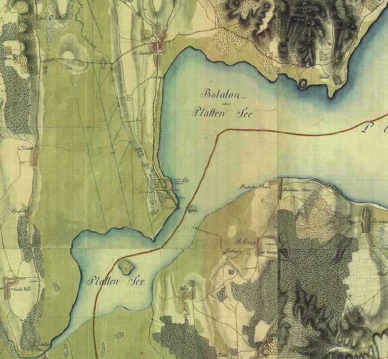
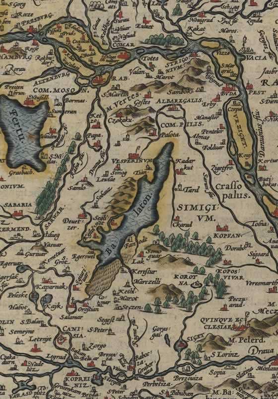
These maps can inform us about that the Roman fortification of Fenékpuszta was known as ’castle’ for the one-time cartographers, as well as about the changes in its environment in the recent centuries. The earliest map was drawn in 1579 which clearly describes the Keszthely peninsula, along with the extension of Kis-Balaton and its related marshy areas. The map by Ignác Müller from 1769 presents the rectangular ground-plan of the ’Romanorum Castellum’ of Fenékpuszta, and the broad Zala River mouth. The two crossings of Fenékpuszta and Hídvég at the western end of Lake Balaton can be perfectly compared on the two maps from the end of the 18th century. The first military survey map of Hungary was compiled between 1763 and 1785 which describes the fortification of Fenékpuszta precisely, as ’Rudera der alten römischen Stadt Cybalis’.